Urban Design
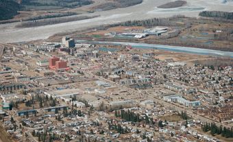
Urban design can be applied to the whole city (as in KITIMAT), to well-defined units of the city (as in Don Mills in Toronto) and to individual streets and clusters of buildings. The earliest extant examples of urban design in Canada are designs for the whole city. Québec City is a compact, fortified city whose design pays respect to church and state and acknowledges its existence to the St Lawrence River. Old Montréal, despite demolition and building, preserves the form of the 18th-century street pattern, crowned by Place d'Armes on the height of land at its centre. Halifax derives its visual character from a generous orthogonal grid of streets laid out by British military engineers.
Design of the Urban Fabric
Since the rapid growth of cities at the end of the 19th century, cities have been planned rather than designed, and the term urban design is applied to parts of a city in which there has been particular emphasis on the visual aspect of the streets and open spaces. Ottawa is perhaps the only Canadian city in which, during the 20th century, design of the urban fabric was considered on a large scale. The visual focus in every new city in the West was on the city hall and legislative buildings (see GOVERNMENT BUILDINGS). The street was an important urban-design element; most towns had their Main St, and Sherbrooke St in Montréal and University Ave in Toronto were grand avenues.
After WWII, when cities grew rapidly, there was less concern for the design of the urban environment than for the design of individual buildings. However, in the new, extensive residential areas there were notable attempts to design the whole environment. Don Mills exemplified these new communities, with curved, treed streets and widely spaced buildings based on the precepts of the Garden City Movement. Don Mills integrated work places, shopping and schools in a design which emphasized pedestrian accessibility and a parklike environment. Later, Flemingdon Park in Toronto answered a demand for higher density with tighter massing of buildings and a harder edge to its streets and paths. Designed with underground car parking, the ground was freed for pedestrian paths and playgrounds, around which groups of houses were focused.
The design of the metropolitan downtown entered a new era with the building from 1956 to 1965 of PLACE VILLE MARIE in Montréal. The project combined retail stores with corporate office space and a major banking hall; introduced the idea of a building complex in which public circulation and access are designed 3-dimensionally, so that entrances are at several levels; made pedestrian connections underground with the public transportation system; and created a plaza for public use. Contrary to fears that business would be diverted from downtown, Place Ville Marie competed with suburban centres and has helped to revitalize the downtown core.
Functions of Civic Space
Historically the paved civic space had not been an important element in Canadian cities, except in the old French cities of Québec. In the early 1960s both private and public projects began to recognize their function, which is quite distinct from park use. For lunch breaks or for public gatherings, celebrations, exhibitions and protests, these plazas or squares created new views in the city and displayed buildings in their entirety as objects. The TORONTO CITY HALL, on Nathan Phillips Square, and Robson Square in Vancouver are examples of such public buildings. At the same time, a populist movement emerged in the cities, with a demand for paths exclusive to pedestrians and the closing of some streets to automobiles, as on the Sparks St Mall in Ottawa (1967).
Many commercial projects have now been built with a plaza on the street or enclosed by buildings. The Toronto Dominion Bank complex in Toronto exemplifies the straight-sided group of towers set in a paved plaza. Commerce Court, Toronto, is a skilful grouping of new buildings that complement the ornate 1931 bank headquarters and enclose a serene courtyard. It introduced another element to contemporary urban design: the plaza which is only glimpsed from the street and provides a pedestrian route through the city block.
The year 1967 was important for urban design in Canada; the celebration of the Canadian Centennial prompted expressions of national and civic pride in new community buildings and parks and also focused attention on a frequently neglected architectural heritage (see HERITAGE CONSERVATION; PUBLIC ART). EXPO 67 also played a significant role as a demonstration of urban-design elements, of elegant street furniture, and of the total composition of paths, spaces and buildings to create a memorable image. In 1971, when the Vincent Massey Awards for Excellence in the Urban Environment were instituted, entries varied from tree-planting programs, housing enclaves, and historic street preservation to promenades.
New City Vantage Points
Designing the city at different levels (on street, below and above ground level) was a response both to a harsh climate and to the demands of circulation in the downtown core. Besides enclosed pedestrian ways between buildings, it produced large-scale indoor gathering places or atria. The extensive underground pedestrian ways in Montréal and Toronto link atria in much the same way that streets link squares. Place Desjardins in Montréal was similarly designed for public gatherings. HUB at the University of Alberta is essentially an elevated indoor street lined with service outlets and stores on the first-floor level and with student housing above and below. One of the largest and most acclaimed of these indoor urban designs is the EATON CENTRE in Toronto, a multilevel street lined with stores and services, connected to the subway and to other city blocks under a great vaulted glass roof. Atria add another dimension to the design of cities, particularly when the connection to the street is generous. The weather-protected inner city changes the views of the outer, and affects its appearance. In Calgary the system of glazed pedestrian bridges (known as Plus 15) crosses the streets. Besides linking the public area within the buildings that they connect, the bridges also become a feature in the design of the street and offer a new vantage point from which to view the city. However, the misapplication of this device as a connector of buildings without regard to streetscape and views can be disastrous in terms of urban design. A notable example is the pedestrian bridge across Rideau St in Ottawa, which reduces the scale of this important street, obscures the view of Parliament and reduces the sense of arrival at the central space of Confederation Square.
The form of some small northern towns was founded on protection from severe winter climate. Towns such as Churchill, Man, are focused on the principal building of the town, which houses most of the public and private communal services, and on indoor public space - replacing the town square. Fermont, Qué, is designed to mitigate the winter cold in the town as a whole. Public services, retail stores and apartments are housed in a single long building which is placed to protect the cluster of lower houses from the winter winds.
Opportunities for Change
The visual aspect of the city changes with the economy and with cultural custom and fashion. As industry left the city centre and as the railways and harbours declined, underutilized and derelict properties created an opportunity for new design of city sectors. Since 1970, downtown railway property has been the subject of urban design competitions, as in Regina and Toronto. With increasing leisure time and the demand for entertainment and consumer goods, the old working waterfronts are being converted to housing, shopping and marinas, with an emphasis on public open space and pedestrian access to the water edge. Halifax, Toronto and Québec City present the most extensive examples of recent urban design on the waterfront which is based on an openness of the ground plane and unconfined views. EXPO 86 in Vancouver provided the opportunity for similar new design of the waterfront, with some major semipublic buildings remaining as a legacy of the exhibition. Even in smaller towns, a "window" on the waterfront is now considered a desirable amenity.
Cultural change which promoted populism in the late 1960s and the subsequent affluence of the 1970s combined to change the public attitude to streets and public places - no longer merely to pass through but to linger in. Sidewalk cafes appeared with attendant shrubbery and light standards; benches, trees and planters were installed on the sidewalks; and small pockets of wasteland between buildings were converted to miniparks. These measures served to soften the contemporary city image but generally lacked the scale of significant street design. The planters, benches, quaint lamp standards and potted trees of Sherbrooke St in Montréal tend to make an obstacle course of the sidewalk. By comparison, the large shade trees with which it formerly was lined gave Sherbrooke St the scale and grandeur which is appropriate to a principal street of a major city.
Natural Heritages
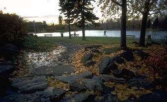
Populism, conservation of natural heritage, and later an interest in fitness and exercise focused interest on parkland, tree planting, walking and bicycle trails. Examples are the Lachine Canal park in Montréal (also a declining industrial area) and the ravine system of walks in Toronto. These pedestrian paths add another dimension to the design of the city, since they do not follow the road system and consequently the urban scene is perceived in a different way. Wascana Centre in Regina is a noteworthy example of urban design of the 1970s which focuses on an artificial lake and park, around which are grouped public buildings in the tradition of the Garden Cities Movement.
In the wake of skyscrapers, megaprojects, plazas and atria came a growing concern for the older fabric of the city, for the preservation of historic buildings and for housing. Consequently, in the 1980s an increasing number of projects were designed on a modest scale, rehabilitating and preserving the heritage of familiar streets. From the steep, picturesque streets of St John's, Nfld, to Bastion Square in Victoria, in many cities and towns and along innumerable main streets, there was a greater recognition of the worth of the urban image.
In the 1980s, dissatisfaction with sprawling suburbs and dependence on the automobile prompted the design of residential enclaves at a higher density, such as False Creek in Vancouver. In the 1990s a further concern with environmental issues prompted the Ontario Government to mount a competition for the design of the new town of Seaton, intended as a self-contained community and preserving the natural features of streams, hills and forest.
See also LANDSCAPE ARCHITECTURE.

 Share on Facebook
 Share on X
 Share by Email
 Share on Google Classroom


