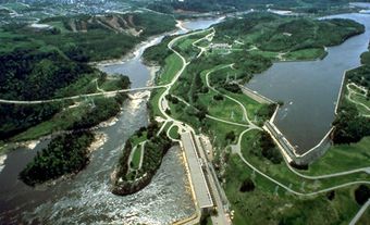
The Niagara River, 58 km long, issues from Lake Erie and flows north over Niagara Falls to Lake Ontario. The river’s drainage area is about 684,000 km2, and its average flow at Queenston is 5,885 m3/s. The Niagara River forms part of the border between Canada and the United States.
Indigenous Peoples
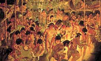
The Iroquoian-speaking Neutral lived throughout the Niagara Peninsula, between the Grand and Niagara rivers. They were called Neutral by the French, who observed that the tribe remained neutral in most conflicts between the Huron-Wendat and the Haudenosaunee. In addition to hunting and fishing, the Neutral grew squash, beans and corn, and their villages included longhouses.
Did you know?
Niagara is derived from an Indigenous word, likely from within the Iroquoian language family (see Indigenous Languages in Canada). However, its exact origins and meaning are unknown. There are two common interpretations. First, that it means “thundering waters,” referring to Niagara Falls. Second, that it means “neck,” referring to the way in which the Niagara River connects lakes Erie and Ontario.
In 1647, several Neutral villages were conquered by the Seneca from the east side of the Niagara River. Later, in the early 1650s, additional villages were destroyed by the Haudenosaunee. These attacks, combined with the smallpox epidemics of 1638–40, meant the Neutral population largely ceased to exist. They were last mentioned in the writing of French explorers in 1671. The Haudenosaunee, however, continued to live in the region as the French, British and Americans fought for control. By the early 1700s they had been joined by the Anishinaabeg, in particular the Mississauga, who were migrating westward from the continent’s northeast coast.
Transportation

The upper section is navigable for small pleasure craft to a series of rapids above the falls. The lower section of the river is navigable for all craft as far upstream as Queenston and Lewiston. Below the falls the river flows through a spectacular gorge and is extremely deep, apart from two vigorous rapids.
The Niagara River is crossed by several bridges. The Peace Bridge (1927) connects Fort Erie to Buffalo, New York. Similarly, the Rainbow Bridge (1941) connects the cities of Niagara Falls, Ontario, and Niagara Falls, New York. The Queenston Bridge (1962) is located at the north end of the gorge.
Niagara Historic Frontier
The French recognized the importance of the Niagara River for the fur trade and as a route into the interior. They built Fort Niagara at its mouth in 1678. The British gained control in 1759 and the fort was a major supply depot during the America Revolution. Two consequences of the revolution were that in 1783 the river became part of the boundary between British and American territory, and Niagara-on-the-Lake and Fort Erie were settled by fleeing Loyalists. The river was crossed by forces on both sides during the War of 1812. Today, the Niagara historic frontier has numerous historic sites.

 Share on Facebook
 Share on X
 Share by Email
 Share on Google Classroom
