Hydrography is the science of surveying, charting and describing physical features of Oceans, seas, Rivers and Lakes.
Originally, hydrography encompassed much of Oceanography, plus the general observation, measurement and description of scientific phenomena at sea, but since the voyages of HMS Challenger (1872-76) there has been increasing specialization in the marine sciences. Oceanography has developed as a separate field and hydrography now concentrates on seafloor surveys, studies of tidal phenomena and provision of navigational charts and associated publications. These publications include Tide and current tables, current atlases and sailing directions ("pilots"). European oceanographers sometimes refer to the measurement of the physical properties of water as hydrography.
Data collected in the field are considerably refined and condensed. Only a representative set including all critical information, such as the least depth over shoals, appears on the published chart. Typically, there is a scale reduction of 2-4 times from the field document to the chart. The chart also includes data from other sources, foreign surveys and charts, engineering drawings of wharves and structures, dredging plans, details of navigational aids (eg, Lighthouses, Buoys), etc. Tidal data are analysed for astronomical influences and are used to predict future tides. An international depository of worldwide tidal information is held at the Marine Environmental Data Service (MEDS) in Ottawa. The charts are complemented by "Sailing Directions," providing a written description of information which cannot be shown clearly on the chart itself. These volumes are referenced to the chart and include information on courses, environmental conditions, dangerous hydrographic features (eg, shoals, strong currents) and port facilities. One volume includes the history of early arctic exploration.
Nautical surveying can be traced to medieval times, and a form of sailing directions is reputed to have been available much earlier. Major advances in marine Cartography took place in the 16th century in conjunction with the expansion in Exploration. Early hydrographic surveys and charts resulted from private initiatives. The establishment of national hydrographic departments in France (1720) and Great Britain (1795) was important to Canada, as early surveys of the Canadian coast were conducted by these agencies, with contributions by the Spanish on the Pacific coast. On the Atlantic coast the surveys of Joseph Frederick Wallet Desbarres and Captain James Cook were particularly notable. Cook's surveys of the St Lawrence R contributed to the success of the British navy in bringing Wolfe's troops to Québec in 1759.
In the Arctic, early hydrographic knowledge was gained from the explorations for the British navy of William Edward Parry and John Franklin, and from those who came in search of Franklin in the latter part of the 19th century. In 1883, following the loss of the steamship Asia in Georgian Bay, the first Canadian survey, the Georgian Bay Survey, was formed under Staff Commander J.G. Boulton, RN. In 1904 the Canadian government formed the Hydrographic Service, taking over completely from the British the charting of Canadian Coastal Waters. However, the task of completing the work is so great that today many charts still include data collected by British and French naval hydrographers.
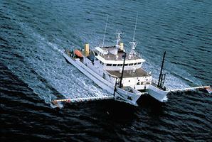
Over the years the Canadian Hydrographic Service has evolved, and today operates from headquarters in Ottawa and regional offices in Sidney, BC; Burlington, Ont; Mont-Joli, Qué; and Dartmouth, NS. The Canadian Hydrographic Service, headed by the Dominion hydrographer, is now part of the Department of Fisheries and Oceans. The service is responsible for conducting surveys of all navigable Canadian waters, including inland waterways. It maintains over 1000 navigational charts. During recent years there has been a determined effort to develop expertise in hydrography in industry, and an increasing proportion of the work, particularly that required for offshore oil and natural-gas exploration, is now done outside government. Hydrography is now taught as a specialization of survey engineering at U of New Brunswick. Hydrographic surveyors are usually graduates of technical survey courses or university mathematics or engineering programs who receive special training, often from the CHS. Humber College (Toronto) offers a diploma program in hydrographic surveying.
Canada is a member of the International Hydrographic Organization (est 1921), which has its headquarters in Monaco. This organization works towards ensuring chart uniformity and chart exchange on a worldwide basis and, in collaboration with the Intergovernmental Oceanographic Commission, is responsible for the General Bathymetric Chart of the Oceans. Canada has been particularly active in contributing to this mission.

 Share on Facebook
 Share on X
 Share by Email
 Share on Google Classroom


