Aeolian Landform
Aeolian landform is a feature of the Earth's surface produced by either the erosive or constructive action of the wind. The word derives from Aeolus, the Greek god of the winds.
Wind erosion processes consist of abrasion, the scouring of exposed surfaces by the sand-blasting action of wind-borne material; and deflation, the removal of sand-sized and smaller particles by the wind. Sand is transported short distances as individual grains or by saltation (a form of movement in short leaps) to form distinct constructional bedforms at various scales: aeolian ripple ridges (a few centimetres in width), meso-dune forms (a few metres in diameter), dunes (several tens to a hundred metres in size), and, finally, ergs (several square kilometres or more). The finer silt-sized particles are transported by airflow turbulence in suspension over much greater distances to form loess. Wind transportation causes attrition of the moving particles, which rub one another and develop characteristic surface frosting and pitting.
Wind abrasion produces ventifacts (faceted pebbles) found in certain parts of Canada where sand dunes occur; furrowed bedrock surfaces common in northern Saskatchewan and Alberta; and yardangs (sharp-crested ridges carved from soft but coherent deposits) found mainly in desert regions.
Deflation produces wind pits, deflation depressions and basins, all common in dune areas in Canada. Large-scale wind erosion contributed indirectly to the preferential orientation of coulees, running parallel to the dominant chinook winds in southern Alberta. The process of winnowing through deflation, whereby the smaller grains are carried off by the wind, leaves behind a layer of pebbles and boulders called lag gravel or reg which protects the ground surface from further erosion. These layers are common in some dune areas in Canada, the most spectacular ones occurring south of Lake Athabasca.
Sand dunes are not limited to desert regions, since aeolian features that were once active and are now stabilized are widespread in many temperate and cold zones. Sand-dune areas cover about 26 000 km2 or approximately 0.27% of the total area of Canada: Alberta has 45%; Saskatchewan, 36%; and Manitoba, 10%. The concentration of dune areas on the prairies results from the availability of suitable sandy deposits left behind by glaciers, the frequent occurrence of dry, westerly winds and the openness of the region. The higher concentration of dunes further west, nearer to the Rocky Mountains, is a direct consequence of the effects of the chinook winds blowing off the mountains. The dominant, westerly winds produced the easterly oriented dunes. Elsewhere in Canada, less effective dry winds produced local dune areas.
Near the end of the Quaternary ice age, the retreating continental glacier controlled the distribution of regional air masses by effectively blocking the southward flow of polar air currents. Instead, it produced its own gravity airflow that descended radially towards the margins of the ice sheet and was gradually deflected clockwise by the Coriolis force. Upon reaching the ice margin, the dry, cold winds were blowing southwestward in the St Lawrence Lowlands of Québec in the east and northwestward in northern Saskatchewan and Alberta in the west, producing correspondingly oriented dunes in those areas. These are also the only 2 regions in Canada where such early postglacial dunes formed by glacier-controlled adiabatic winds are preserved. In the areas south of the centre of the ice sheet in Ontario and Manitoba, the effects of these adiabatic winds were not registered in aeolian deposits because of the presence of extensive glacial lakes.
Dune Activity
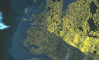
Most of Canada's dune areas are stabilized by vegetation; relatively few are active, except in the area south of Lake Athabasca. This region contains 385 km2 of barren sand surfaces, recognizable on satellite photos, with beautiful, active sand dunes producing breathtaking scenery. This large-scale aeolian activity is, however, not climatically controlled but is due to the prevailing local groundwater conditions. In Canada only about 2.5% of the total dune area is active; 95% of that total occurs in the Lake Athabasca region. Although this region has been active since its formation following deglaciation, elsewhere in Canada, recent dune activity is related to local climate conditions with human or animal activity being the triggering mechanism to start it.
Dune Forms
One common feature of almost all sand dunes in Canada, which distinguishes them from desert dunes, is that they show some parabolic form, concave upwindward. This shape develops as a resistance form to airflow, resembling abrasional landforms when the sand in them is humid. This is in contrast to desert dunes, which are transport bed forms through which sand is displaced freely by the wind. Moisture in the parabolic dunes provides the sand grains with apparent cohesion, adhering to one another and resisting removal by the wind, just as moist sand on the beach used in building sand castles resists gravity. Individual dunes or groups of dunes may have either simple or complex parabolic forms, depending on the mode and duration of their development and complex history of stabilization and reactivation.
The dune areas of Canada have been grouped into a series of regional zones according to differences in dune form. Each zone has either distinct aeolian environmental characteristics or has had a particular aeolian history. Interestingly enough, the boundaries of these regional zones closely follow those of the vegetation zones.
In every dune area, local aeolian activity began as soon as sandy surfaces became exposed to the air after the disappearance of the glacial ice. In more humid regions, activity generally lasted for only a short time. Dry winds blowing from one direction or another amassed the sand to form either transverse or parabolic dunes. Transverse dunes persisted only as long as the sand in them remained dry. When moistened by rainfall, they broke up into parabolic dunes.
History of Aeolian Activity
In the valley of the Athabasca River in central Alberta, dunes showing stages of transformation from the original transverse to parabolic dunes have been preserved due to very rapid stabilization. In the presently drier regions of the prairies in southwestern Saskatchewan and adjacent Alberta, where the ice sheet retreated by around 13 000 years ago, the first stage of large-scale aeolian activity lasted until about 11 000 years ago, when the world climate became somewhat cooler.
On the prairies, cooling resulted in more humid conditions, promoting the development of vegetation not only in the interdune areas but on the dunes themselves, stabilizing them and protecting them from further wind erosion. Equally, stabilizing vegetation extended onto other aeolian sediments like loess and cliff-top deposits, resulting in the development of humus-rich soils on them. When the warmer and drier climate returned to the southern prairies about 1000 later, widespread aeolian activity started again. This time, it lasted for several thousands of years, during which dunes migrated downwind for great distances and dune areas expanded onto adjacent land surfaces. All the while vegetation may have persisted locally in the interdune areas.
The shape of dune areas indicates that this aeolian activity went on for a long time. Differences in the shape of dune areas in the more arid and more humid regions, however, suggest that dune activity went on for longer, for example, in the Great Sand Hills of southwestern Saskatchewan, a more arid region, than in the Brandon Sand Hills of southern Manitoba, a more humid area.
When the climate finally began to turn increasingly more humid again sometime around 4000 to 5000 years ago, the dunes and dune areas were gradually stabilized by vegetation, and soils developed on them again. Since then, periodic climate fluctuations have caused many of the dunes to become partly active from time to time, burying parts of their stabilized surfaces and soils.
Radiocarbon dating of organic material extracted from buried soils has helped to show that more than 10 periods of renewed aeolian activity have occurred in the last 5000 years. These periods correlate well with other climate-sensitive phenomena such as tree-ring development and lake sediment stratigraphy. In Canada, loess deposits are generally small in area and usually occur downwind from dune areas. Locally, they hide wind-abraded surfaces and, in turn, have been partly overridden by advancing dune fields. Other aeolian deposits, still less extensive but equally important, include cliff-top deposits formed by sediments that were deflated from barren, cliffy slopes exposed to the winds. Occurrences of these on the southern prairies have been the sites of past volcanic ash deposition, for example, the Mazama ash in the cliff-top deposits of southwestern Saskatchewan and adjacent Alberta.
Aeolian cliff-top deposits are much more widespread in Canada than has so far been recognized. In mountainous regions with high cliffs exposed to exceptionally violent wind storms, such as those along the north shore of Gaspé Peninsula in Quebec, disk-shaped rock particles, as large as 5 to over 120 cm in diameter, have been lifted up to the top of cliffs resulting in low and narrow ridge-like cliff-top accumulations.
See also Glaciation.

 Share on Facebook
 Share on X
 Share by Email
 Share on Google Classroom


